As a result, DB of a complex of geophysical fields is created on a significant part of water area of the Northwest shelf of Russia (fig. 1). The GIS-technology of the complex analysis of the geophysical data and their cartographical visualisation is organised. This technology can be applied at formation of a DB within the other works by virtue of its "openness".
Representations about a structure and tectonic development of investigated area of the Earth are the initial data at planning search prospecting works on oil and gas. Geophysical methods get the leading part at researches on water areas where direct geological supervision have fragmentary character. Their absolute leader is seismic prospecting. However high cost of works for the Arctic shelf forces to use the complex approach to interpretation of all already available geophysical data in a full way.
One of probable variants of the complex approach to the geophysical information is developed and approved within the framework of the program of drawing up of geophysical bases, as anticipating and accompanying stages of creation of the State geological map of Russia of scale 1:1 000000 (Geolkarta-1000).
Geophysical mapping, which is executed by us on the Northwest shelf of the Russian Federation (sheets R-38-40, S-41-43, T-37-40), is based on the principle of formation of the co-ordinated digital geophysical databank (DB) within the framework of geoinformation technologies. The initial information are long-term results of the works executed by the various organisations and generalised within the framework of industrial, research reports. Result of generalisation and interpretation of the information is a series of digital models of maps and sections, including:
- maps of abnormal gravitational field in a reduction of Buge;
- map of abnormal magnetic field;
- maps of gradients of gravitational and magnetic fields;
- maps of residual anomalies;
- geological-geophysical sections on the basis of the seismic data;
- maps and the schemes reflecting results of interpretation of all geophysical data.
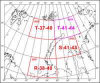
Fig. 1. Sheets of geophysical basis Geolkarta-1000 which have been prepared
(R-38-40, S-41-43, T-37-40) and are prepared (T-41-44) in MAGE.
Processing of such significant volume of the information is executed with use of modern technologies in geoinformation system (GIS) ArcView 3.2. The additional program modules integrated into ArcView environment, are created for simplification of a problem of a manipulation, processing, storage and display of the information.
The sheme of division of districts on features of geophysical fields was included in the complete set of maps. The cluster analysis of geophysical fields and their transformations has been based divisions into districts. The cluster analysis is mathematical procedure of the multivariate analysis and, with reference to geophysical researches, allows on the basis of several parameters (geophysical fields and their transformations) to allocate areas, inside which characteristics of fields rather identical. Results of this analysis have been used further at the construction of geological maps and schemes, in particular, maps of prospects on oil and gas.
The Literature:
1. Vasiliev V.V., Vaskovskii B.V., Pogareva O.I., Saprikin Iu.F. The geophysical survey: problems of unification of the information. Book of Abstracts 2nd International Conference 'Problems of geocosmos', SPb, June 29-July 3, 1998, p. 29-30.
2. Vasiliev V.V. The computation of summary digital models of fields in conducting overlapping airborne radiometric surveys. Book of Abstracts International Geophysical Conference, SPb, Oct. 2-7, 2000, pp. 531-533.
3. Vasiliev V.V., Vasilieva E.G., Zhuravlev V.A. GIS-presented Geophysical Results of the Offshore Portion of the Timan - Pechora Oil and Gas Bearing Basin. The International Conference "Oil and gas of Arctic shelf". Murmansk, Nov. 13-15, 2002.//
4. Инструкция по составлению и подготовке к изданию листов Государственной геологической карты Российской Федерации масштаба 1 : 1 000 000 (третьего поколения). СПб, Изд. ВСЕГЕИ, 2002, 240 с.
5. Коротких Е.Г., Шкарубо С.И. Опыт и проблемы составления Государственной геологической карты в среде ArcView. "Геодезия и картография", 9'1999, с. 37-38.
6. Васильева Е.Г. Создание цифровых моделей геофизических карт в среде ГИС ArcView. "Геофизический вестник" 11'2001, с. 8-11.